Geographic Information Systems (GIS)
Geographic Information Systems (GIS) is a powerful tool that provides the ability to gather, manage and analyse spatial data. By utilising location information, organising information into layers and visualising information on a map, we are able to identify patterns and relationships that are otherwise unclear.
Out team utilises GIS across all areas of the business by incorporating spatial analysis and map production into our projects. GIS can help visualise data and solve complex problems across a wide range of industries including:
- Land use planning
- Catchment scale water use and management
- Horticulture industry development
- Agriculture industry strategic planning
- Planning and evaluation of natural resource management.
We have the skills to analyse spatial data; produce high quality maps in print, digital and online interactive formats; and develop, verify and maintain spatial datasets. RMCG and our Tasmanian team also have the capacity to provide project support in mapping to other consultancy firms who wish to outsource the mapping component of their projects, with QGIS being our preferred GIS platform.
Using data in a spatial form adds significant value and clarity to the story being told. We are able to display data such as ABS Census data in a meaningful way that is easy to understand. We can utilise spatial data to analyse risk, allowing us to identify locations that have a higher risk factor based on the likelihood and consequence of a potential threat occurring. We can also produce high quality maps that add a valuable visual element to the data analysis and narrative.
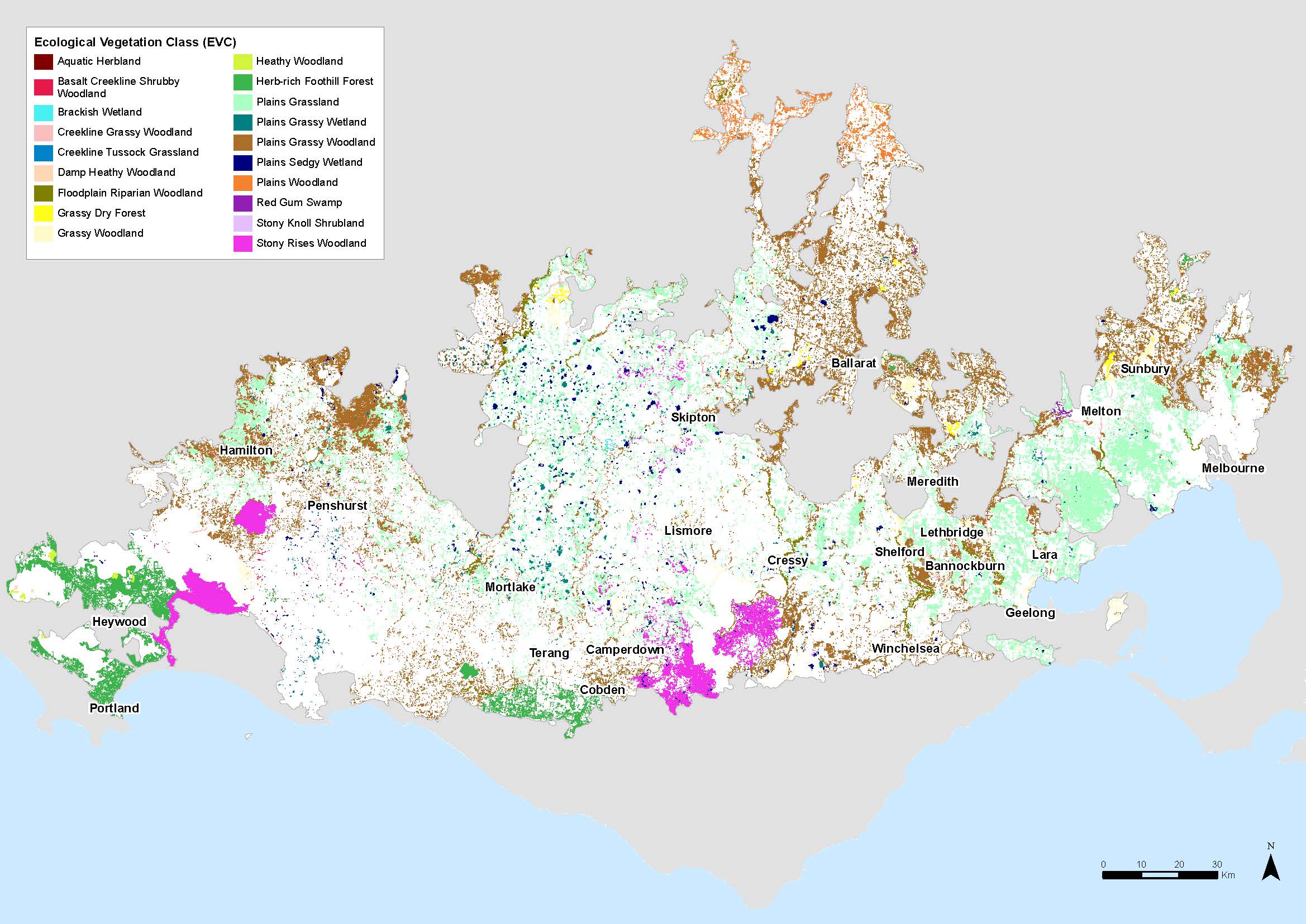
An example of a GIS map of Ecological Vegetation Classes in Victoria.
Our GIS offering
- Property maps: We can produce the maps required for all the services we provide. We can also produce maps as required by clients, for example farm layouts or concept plans showing paddocks, pivots, infrastructure, etc.
- GIS constraints model: We have developed a GIS model for determining land that is constrained for agricultural use. The outputs of the model assist in determining appropriate zoning boundaries.
- Crop suitability model: Our Tasmanian team developed industry specific models to determine suitability of land for particular developments, for example a vineyard suitability model identifies land in the West Tamar Municipality that is suitable for vineyard development. These models pre-date the State Government’s Enterprise Suitability models and include input from industry specialists. They are designed to be used in conjunction with other tools such as Constraints Analysis and Enterprise Scale to assist with determining agricultural potential of land which is sought after for alternative use such as residential purposes.
- Geo-referenced mapping: We can produce geo-referenced maps compatible with software such as Avenza Maps, which is free to download and install on smartphones or tablets. Georeferenced maps provide location in the field and can be used for ground truthing the location of a new dam, fenceline, etc.
- Training in using field based applications: We provide training in the use of georeferenced maps for field based applications.
Click here for more information on how GIS has been used to support RMCG’s recent projects.